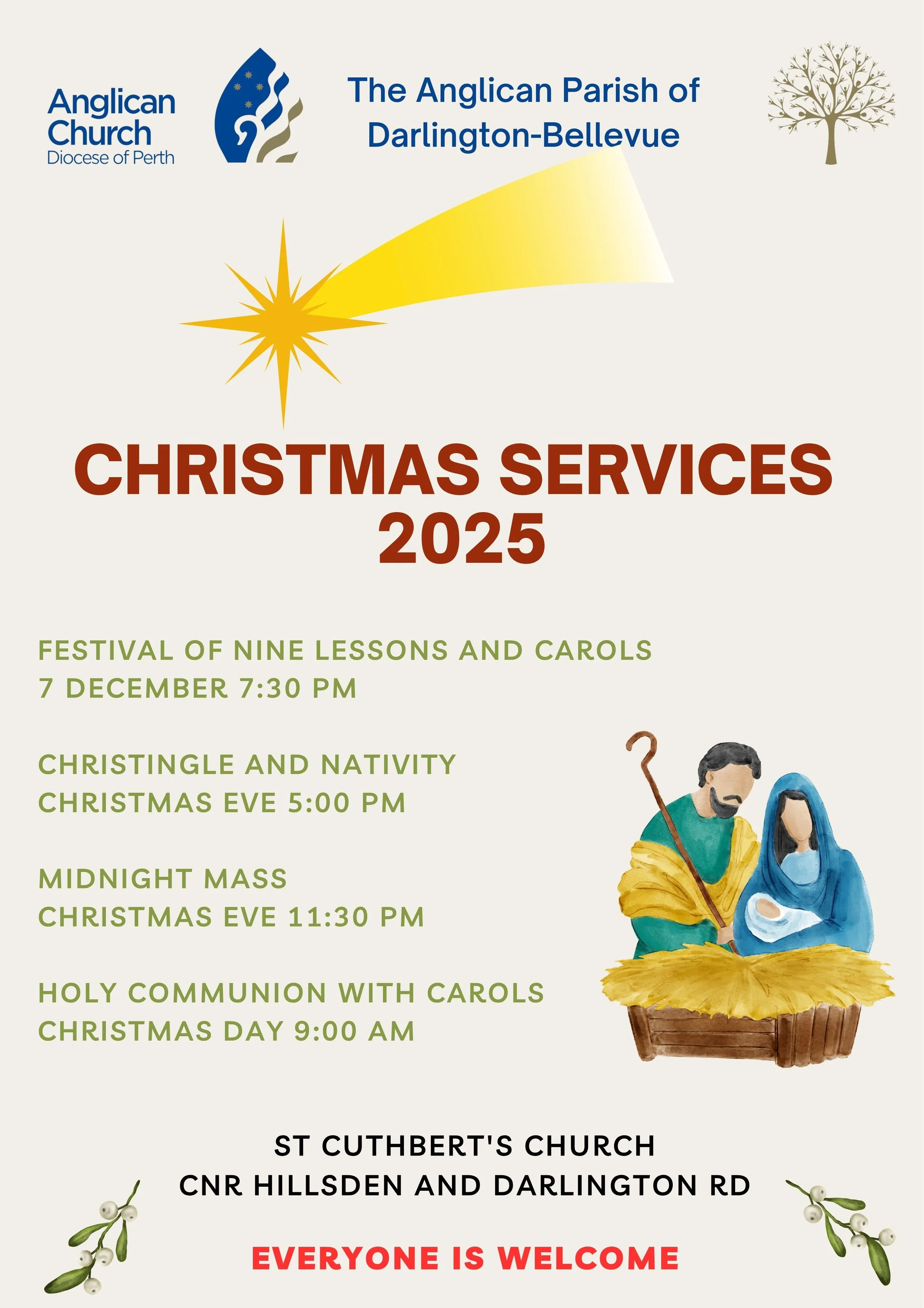
BEATING THE BOUNDS! Saturday 13 & Sunday 14 September Flyer
This page shares updated information on this event. The route below is also in this document which includes images from Google Maps for 19 legs of the route: Beating the Bounds Route
SATURDAY
1. St Cuthbert’s to Lionel & Bertram https://maps.app.goo.gl/MS64FDtv27NNxpaD7
2. Lionel & Bertram to Lionel & Marnie https://maps.app.goo.gl/2FctEEpSXXbdtmHM9
3. Lionel & Marnie to Mayew & Darlington https://maps.app.goo.gl/x5dK7SNa9aw84gNh9
4. Mayew & Darlington to Padbury (across rd) https://maps.app.goo.gl/E2n1nSh8SeqQtZ7C7
5. Padbury to Padbury and walking track https://maps.app.goo.gl/Pna2Y8rHXnDahR6T7
6. Walking track to The Goat Farm Bike Park, https://maps.app.goo.gl/tUegWcmcVSxLr17YA
7. The Goat Farm Bike Park to Coongan & Scott https://maps.app.goo.gl/QXsmtXcrNHNw4ov4A
8. Coongan & Scott to Purto & Miller https://maps.app.goo.gl/aJGzhBx7DgLSKw3PA
9. Purton & Miller to Riverside Pk, Lakeside,https://maps.app.goo.gl/pW7vfcqFKqoGQ5NA6
10. Riverside pk, Lakeside Dr to Broz Park (Lake) https://maps.app.goo.gl/jFNXsV2fVr8zixFj6
SUNDAY
11. Broz Park to Helena Valley & Midland Rd https://maps.app.goo.gl/Jp5dAa2ZxYZNZfr77
12. Helena V & Midland Rd to Midland & Sadler https://maps.app.goo.gl/UXWxtK1zGfcmJ7rH6
13. Midland Rd & Sadler to Broadmeadows Dr https://maps.app.goo.gl/tbBJ4nzyH28qXrop7
14. Cut across open land to Ridge Hill Rd (head east)
15. 210 Ridge Hill to Ridge Hill & Helena V Rd https://maps.app.goo.gl/URWgL4nAcp4VvQT96
16. Ridge Hill & Helena Valley to Clayton & Approach https://maps.app.goo.gl/c3XUqS7FVWusRaix6
17. Clayton and Approach to Hudman Rd https://maps.app.goo.gl/HRFz2Ms53zuVkzLq9
18. Cut across to walking track parallel to Coulston Rd
19. Walking track to St Cuthbert’s https://maps.app.goo.gl/m4nzytpZKF2k8H2Q8